
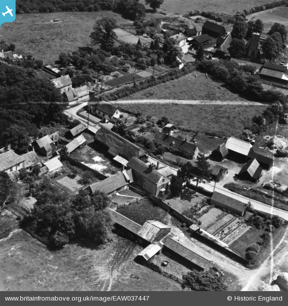
eaw037447 ENGLAND (1951). Rectory Farm and the village, Little Eversden, 1951. This image has been produced from a print marked by Aerofilms Ltd for photo editing.
© Copyright OpenStreetMap contributors and licensed by the OpenStreetMap Foundation. 2024. Cartography is licensed as CC BY-SA.
Nearby Images (5)
EAW037447

EAW037449

EAW037448

EAW037450

EAW037446

Details
| Title | [EAW037447] Rectory Farm and the village, Little Eversden, 1951. This image has been produced from a print marked by Aerofilms Ltd for photo editing. |
| Reference | EAW037447 |
| Date | 2-July-1951 |
| Link | |
| Place name | LITTLE EVERSDEN |
| Parish | LITTLE EVERSDEN |
| District | |
| Country | ENGLAND |
| Easting / Northing | 537338, 253327 |
| Longitude / Latitude | 0.0080292771213023, 52.160701183478 |
| National Grid Reference | TL373533 |
Pins
Be the first to add a comment to this image!


