
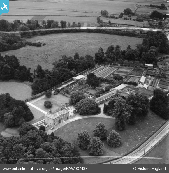
eaw037438 ENGLAND (1951). Dullingham House, Dullingham, 1951. This image has been produced from a print marked by Aerofilms Ltd for photo editing.
© Copyright OpenStreetMap contributors and licensed by the OpenStreetMap Foundation. 2024. Cartography is licensed as CC BY-SA.
Nearby Images (8)
EAW037438

EAW037440

EAW037439

EAW037442

EAW037444

EAW037445

EAW037441

EAW037443

Details
| Title | [EAW037438] Dullingham House, Dullingham, 1951. This image has been produced from a print marked by Aerofilms Ltd for photo editing. |
| Reference | EAW037438 |
| Date | 2-July-1951 |
| Link | |
| Place name | DULLINGHAM |
| Parish | DULLINGHAM |
| District | |
| Country | ENGLAND |
| Easting / Northing | 562742, 258000 |
| Longitude / Latitude | 0.38138532947301, 52.19577769752 |
| National Grid Reference | TL627580 |
Pins
Be the first to add a comment to this image!


