
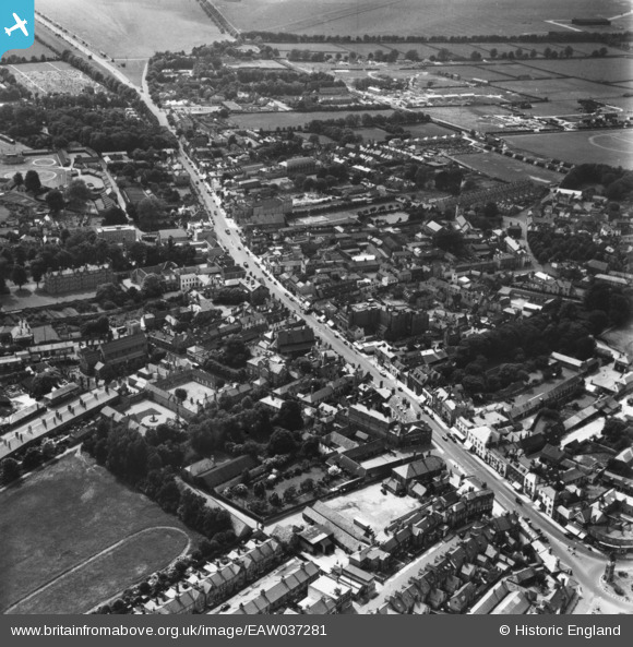
eaw037281 ENGLAND (1951). The High Street and town, Newarket, 1951. This image has been produced from a print.
© Copyright OpenStreetMap contributors and licensed by the OpenStreetMap Foundation. 2024. Cartography is licensed as CC BY-SA.
Nearby Images (5)
EAW037281

EPW049263

EPW001754

EPW001757

EAW037280

Details
| Title | [EAW037281] The High Street and town, Newarket, 1951. This image has been produced from a print. |
| Reference | EAW037281 |
| Date | 21-June-1951 |
| Link | |
| Place name | NEWMARKET |
| Parish | NEWMARKET |
| District | |
| Country | ENGLAND |
| Easting / Northing | 564337, 263368 |
| Longitude / Latitude | 0.40731006908008, 52.243527842707 |
| National Grid Reference | TL643634 |
Pins
Be the first to add a comment to this image!


