
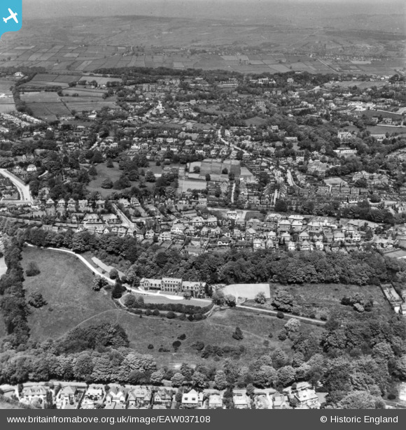
eaw037108 ENGLAND (1951). The United Sheffield Hospitals Rehabilitation Centre, the residential area at Stumperlowe and environs, Fulwood, from the south, 1951. This image has been produced from a print.
© Copyright OpenStreetMap contributors and licensed by the OpenStreetMap Foundation. 2024. Cartography is licensed as CC BY-SA.
Nearby Images (4)
EAW037108

EAW037106

EAW037105

EAW037107

Details
| Title | [EAW037108] The United Sheffield Hospitals Rehabilitation Centre, the residential area at Stumperlowe and environs, Fulwood, from the south, 1951. This image has been produced from a print. |
| Reference | EAW037108 |
| Date | 5-June-1951 |
| Link | |
| Place name | FULWOOD |
| Parish | |
| District | |
| Country | ENGLAND |
| Easting / Northing | 431217, 385306 |
| Longitude / Latitude | -1.5308454910065, 53.363437319774 |
| National Grid Reference | SK312853 |
Pins
 Rob |
Friday 1st of May 2020 09:23:50 PM | |
Rob |
Friday 1st of May 2020 09:23:19 PM | |
Rob |
Friday 1st of May 2020 09:20:56 PM |


