
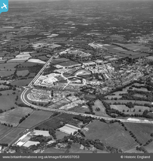
eaw037053 ENGLAND (1951). The residential area at West Green under construction, Crawley, 1951. This image has been produced from a print.
© Copyright OpenStreetMap contributors and licensed by the OpenStreetMap Foundation. 2024. Cartography is licensed as CC BY-SA.
Nearby Images (5)
EAW037053

EAW041923

EAW041931

EAW051191

EAW037051

Details
| Title | [EAW037053] The residential area at West Green under construction, Crawley, 1951. This image has been produced from a print. |
| Reference | EAW037053 |
| Date | 11-June-1951 |
| Link | |
| Place name | CRAWLEY |
| Parish | |
| District | |
| Country | ENGLAND |
| Easting / Northing | 526199, 136990 |
| Longitude / Latitude | -0.19671103723981, 51.117754866741 |
| National Grid Reference | TQ262370 |
Pins
Be the first to add a comment to this image!


