
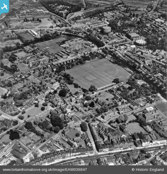
eaw036847 ENGLAND (1951). The playing field in the Cathedral Close, Norwich, 1951. This image has been produced from a print.
© Copyright OpenStreetMap contributors and licensed by the OpenStreetMap Foundation. 2024. Cartography is licensed as CC BY-SA.
Nearby Images (14)
EAW036847

EAW036837

EAW036836

EAW036835

EAW036850

EAW036849

EAW036839

EPW021218

EAW001932

EAW036841

EPW021211

EPW021205

EAW036855

EPW001973

Details
| Title | [EAW036847] The playing field in the Cathedral Close, Norwich, 1951. This image has been produced from a print. |
| Reference | EAW036847 |
| Date | 5-June-1951 |
| Link | |
| Place name | NORWICH |
| Parish | |
| District | |
| Country | ENGLAND |
| Easting / Northing | 623764, 308841 |
| Longitude / Latitude | 1.3069334752357, 52.630761648284 |
| National Grid Reference | TG238088 |
Pins
 Muffet |
Monday 23rd of November 2015 04:14:15 PM | |
Muffet |
Monday 23rd of November 2015 04:11:52 PM | |
Muffet |
Monday 23rd of November 2015 04:10:10 PM | |
Muffet |
Monday 23rd of November 2015 04:08:36 PM | |
Chris Lambert |
Saturday 22nd of August 2015 09:09:52 PM | |
Chris Lambert |
Saturday 22nd of August 2015 09:09:49 PM |


