
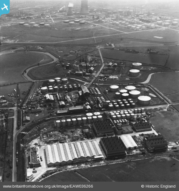
eaw036266 ENGLAND (1951). Part of the Oil Refinery at Stanlow, Ellesmere Port, 1951. This image has been produced from a print.
© Copyright OpenStreetMap contributors and licensed by the OpenStreetMap Foundation. 2024. Cartography is licensed as CC BY-SA.
Nearby Images (29)
EAW036266

EPW046269

EAW036254

EPW046267

EPW046272

EAW036260

EPW046268

EPW046264

EPW046266

EPW046265

EAW001908

EAW036261

EAW036265

EAW036255

EAW036263

EPW046271

EAW036258

EAW038952

EAW038953

EAW038947

EPW046263

EPW046270

EAW036262

EAW038945

EAW038949

EAW038944

EAW036256

EAW036259

EAW036257

Details
| Title | [EAW036266] Part of the Oil Refinery at Stanlow, Ellesmere Port, 1951. This image has been produced from a print. |
| Reference | EAW036266 |
| Date | 12-May-1951 |
| Link | |
| Place name | ELLESMERE PORT |
| Parish | |
| District | |
| Country | ENGLAND |
| Easting / Northing | 342461, 375777 |
| Longitude / Latitude | -2.8629751964589, 53.275573747413 |
| National Grid Reference | SJ425758 |
Pins
Be the first to add a comment to this image!


