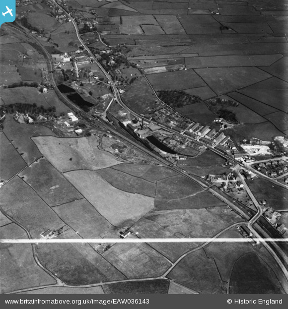
eaw036143 ENGLAND (1951). Blackburn Road, Hope Mill and environs, Rising Bridge, 1951. This image has been produced from a print marked by Aerofilms Ltd for photo editing.
© Copyright OpenStreetMap contributors and licensed by the OpenStreetMap Foundation. 2024. Cartography is licensed as CC BY-SA.
Nearby Images (8)
Details
| Title | [EAW036143] Blackburn Road, Hope Mill and environs, Rising Bridge, 1951. This image has been produced from a print marked by Aerofilms Ltd for photo editing. |
| Reference | EAW036143 |
| Date | 17-May-1951 |
| Link | |
| Place name | RISING BRIDGE |
| Parish | |
| District | |
| Country | ENGLAND |
| Easting / Northing | 377907, 425564 |
| Longitude / Latitude | -2.334878928913, 53.725786386293 |
| National Grid Reference | SD779256 |
Pins
 wadey |
Saturday 18th of April 2015 08:39:43 PM | |
 wadey |
Saturday 18th of April 2015 08:39:14 PM | |
 wadey |
Saturday 18th of April 2015 08:37:27 PM | |
 wadey |
Saturday 18th of April 2015 08:35:56 PM | |
 wadey |
Saturday 18th of April 2015 08:35:19 PM | |
 wadey |
Saturday 18th of April 2015 08:31:37 PM | |
 wadey |
Saturday 18th of April 2015 08:30:45 PM |


![[EAW036143] Blackburn Road, Hope Mill and environs, Rising Bridge, 1951. This image has been produced from a print marked by Aerofilms Ltd for photo editing.](http://britainfromabove.org.uk/sites/all/libraries/aerofilms-images/public/100x100/EAW/036/EAW036143.jpg)
![[EAW036142] Blackburn Road, Hope Mill and environs, Rising Bridge, 1951. This image has been produced from a print marked by Aerofilms Ltd for photo editing.](http://britainfromabove.org.uk/sites/all/libraries/aerofilms-images/public/100x100/EAW/036/EAW036142.jpg)
![[EAW036140] Blackburn Road, Hope Mill and environs, Rising Bridge, 1951. This image has been produced from a print marked by Aerofilms Ltd for photo editing.](http://britainfromabove.org.uk/sites/all/libraries/aerofilms-images/public/100x100/EAW/036/EAW036140.jpg)
![[EAW036144] Blackburn Road, Hope Mill and environs, Rising Bridge, 1951. This image has been produced from a print marked by Aerofilms Ltd for photo editing.](http://britainfromabove.org.uk/sites/all/libraries/aerofilms-images/public/100x100/EAW/036/EAW036144.jpg)
![[EAW036145] Blackburn Road, Hope Mill and environs, Rising Bridge, 1951. This image has been produced from a print marked by Aerofilms Ltd for photo editing.](http://britainfromabove.org.uk/sites/all/libraries/aerofilms-images/public/100x100/EAW/036/EAW036145.jpg)
![[EAW036146] Paragon Chemical Works, Blackburn Road, Hope Mill and environs, Rising Bridge, 1951. This image has been produced from a print marked by Aerofilms Ltd for photo editing.](http://britainfromabove.org.uk/sites/all/libraries/aerofilms-images/public/100x100/EAW/036/EAW036146.jpg)
![[EAW036141] Blackburn Road, Hope Mill and environs, Rising Bridge, 1951. This image has been produced from a print marked by Aerofilms Ltd for photo editing.](http://britainfromabove.org.uk/sites/all/libraries/aerofilms-images/public/100x100/EAW/036/EAW036141.jpg)
![[EAW036139] Blackburn Road, Hope Mill and environs, Rising Bridge, 1951. This image has been produced from a print marked by Aerofilms Ltd for photo editing.](http://britainfromabove.org.uk/sites/all/libraries/aerofilms-images/public/100x100/EAW/036/EAW036139.jpg)


