
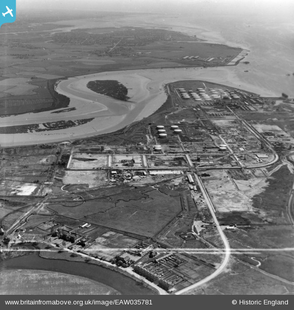
eaw035781 ENGLAND (1951). The Coryton Oil Refinery alongside Holehaven Creek, Coryton, from the west, 1951. This image has been produced from a print marked by Aerofilms Ltd for photo editing.
© Copyright OpenStreetMap contributors and licensed by the OpenStreetMap Foundation. 2024. Cartography is licensed as CC BY-SA.
Nearby Images (9)
EAW035781

EAW047423

EAW048598

EAW035780

EAW034410

EAW048597

EAW048100

EAW048092

EAW034442

Details
| Title | [EAW035781] The Coryton Oil Refinery alongside Holehaven Creek, Coryton, from the west, 1951. This image has been produced from a print marked by Aerofilms Ltd for photo editing. |
| Reference | EAW035781 |
| Date | 12-May-1951 |
| Link | |
| Place name | CORYTON |
| Parish | |
| District | |
| Country | ENGLAND |
| Easting / Northing | 574382, 182460 |
| Longitude / Latitude | 0.51341980354486, 51.513630007578 |
| National Grid Reference | TQ744825 |
Pins
Be the first to add a comment to this image!


