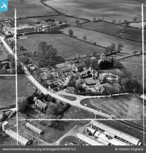
eaw035714 ENGLAND (1951). Bearley Manor, Bearley, 1951. This image has been produced from a print marked by Aerofilms Ltd for photo editing.
© Copyright OpenStreetMap contributors and licensed by the OpenStreetMap Foundation. 2024. Cartography is licensed as CC BY-SA.
Nearby Images (6)
Details
| Title | [EAW035714] Bearley Manor, Bearley, 1951. This image has been produced from a print marked by Aerofilms Ltd for photo editing. |
| Reference | EAW035714 |
| Date | 11-May-1951 |
| Link | |
| Place name | BEARLEY |
| Parish | BEARLEY |
| District | |
| Country | ENGLAND |
| Easting / Northing | 418139, 260627 |
| Longitude / Latitude | -1.7343103362575, 52.2431317965 |
| National Grid Reference | SP181606 |
Pins
 Matt Aldred edob.mattaldred.com |
Thursday 14th of March 2024 01:47:57 PM | |
 Matt Aldred edob.mattaldred.com |
Friday 8th of March 2024 07:02:45 PM | |
 Matt Aldred edob.mattaldred.com |
Friday 8th of March 2024 07:02:21 PM | |
 Matt Aldred edob.mattaldred.com |
Friday 8th of March 2024 07:01:55 PM | |
 Matt Aldred edob.mattaldred.com |
Friday 8th of March 2024 07:01:41 PM | |
 Matt Aldred edob.mattaldred.com |
Sunday 30th of January 2022 04:37:48 PM | |
 Matt Aldred edob.mattaldred.com |
Sunday 30th of January 2022 04:36:27 PM |


![[EAW035714] Bearley Manor, Bearley, 1951. This image has been produced from a print marked by Aerofilms Ltd for photo editing.](http://britainfromabove.org.uk/sites/all/libraries/aerofilms-images/public/100x100/EAW/035/EAW035714.jpg)
![[EAW035709] Bearley Manor, Bearley, 1951. This image has been produced from a print marked by Aerofilms Ltd for photo editing.](http://britainfromabove.org.uk/sites/all/libraries/aerofilms-images/public/100x100/EAW/035/EAW035709.jpg)
![[EAW035710] Tudor Cottage and Bearley Manor, Bearley, 1951. This image has been produced from a print marked by Aerofilms Ltd for photo editing.](http://britainfromabove.org.uk/sites/all/libraries/aerofilms-images/public/100x100/EAW/035/EAW035710.jpg)
![[EAW035711] Bearley Manor, Bearley, 1951. This image has been produced from a print marked by Aerofilms Ltd for photo editing.](http://britainfromabove.org.uk/sites/all/libraries/aerofilms-images/public/100x100/EAW/035/EAW035711.jpg)
![[EAW035712] Bearley Manor and the village, Bearley, 1951. This image has been produced from a print marked by Aerofilms Ltd for photo editing.](http://britainfromabove.org.uk/sites/all/libraries/aerofilms-images/public/100x100/EAW/035/EAW035712.jpg)
![[EAW035713] Bearley Manor, Bearley, 1951. This image has been produced from a print marked by Aerofilms Ltd for photo editing.](http://britainfromabove.org.uk/sites/all/libraries/aerofilms-images/public/100x100/EAW/035/EAW035713.jpg)


