
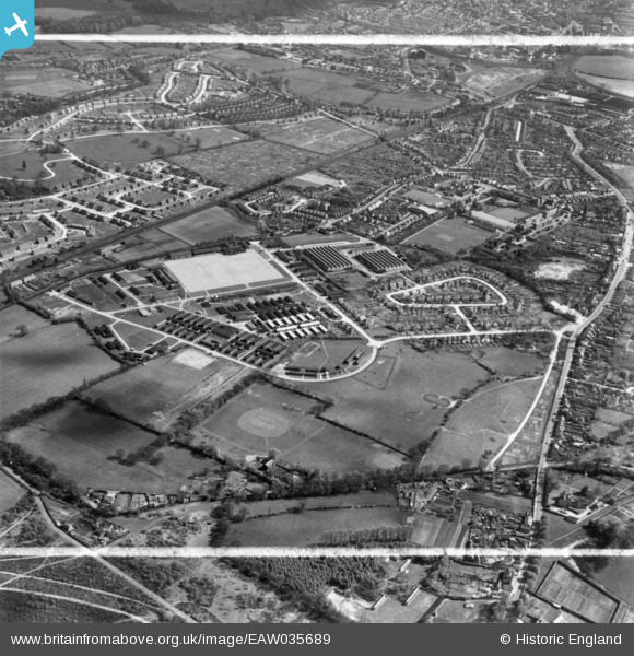
eaw035689 ENGLAND (1951). Stoughton Barracks and environs, Guildford, 1951. This image has been produced from a print marked by Aerofilms Ltd for photo editing.
© Copyright OpenStreetMap contributors and licensed by the OpenStreetMap Foundation. 2024. Cartography is licensed as CC BY-SA.
Nearby Images (5)
EAW035689

EPW054849

EAW035688

EPW054846

EAW035681

Details
| Title | [EAW035689] Stoughton Barracks and environs, Guildford, 1951. This image has been produced from a print marked by Aerofilms Ltd for photo editing. |
| Reference | EAW035689 |
| Date | 2-May-1951 |
| Link | |
| Place name | GUILDFORD |
| Parish | |
| District | |
| Country | ENGLAND |
| Easting / Northing | 498460, 152331 |
| Longitude / Latitude | -0.58872696950701, 51.261114253089 |
| National Grid Reference | SU985523 |
Pins
Be the first to add a comment to this image!


