
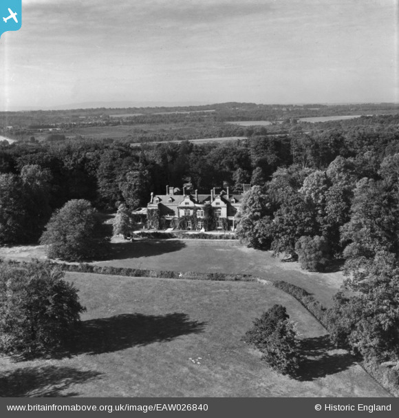
eaw026840 ENGLAND (1949). Ashfold, Slaugham, from the south, 1949. This image has been produced from a print.
© Copyright OpenStreetMap contributors and licensed by the OpenStreetMap Foundation. 2024. Cartography is licensed as CC BY-SA.
Nearby Images (5)
EAW026840

EAW026841

EAW026839

EAW026838

EAW026837

Details
| Title | [EAW026840] Ashfold, Slaugham, from the south, 1949. This image has been produced from a print. |
| Reference | EAW026840 |
| Date | 3-October-1949 |
| Link | |
| Place name | SLAUGHAM |
| Parish | SLAUGHAM |
| District | |
| Country | ENGLAND |
| Easting / Northing | 524728, 128826 |
| Longitude / Latitude | -0.22053793544554, 51.044692446418 |
| National Grid Reference | TQ247288 |
Pins
Be the first to add a comment to this image!


