
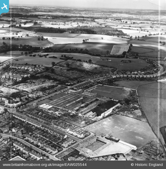
eaw025544 ENGLAND (1949). The W. H. Dorman and Co Ltd Engineering Works and Tixall Road, Stafford, from the west, 1949. This image has been produced from a print marked by Aerofilms Ltd for photo editing.
© Copyright OpenStreetMap contributors and licensed by the OpenStreetMap Foundation. 2024. Cartography is licensed as CC BY-SA.
Nearby Images (31)
EAW025544

EPW056771

EPW056767

EAW025982

EAW025987

EAW025989

EAW025984

EPW056766

EAW025542

EAW025983

EPW056768

EPW056764

EAW025547

EPW056765

EAW025548

EPW056770

EAW036596

EAW025597

EAW036591

EAW036597

EPW056769

EAW036594

EAW036600

EAW025985

EAW036592

EAW025988

EAW025545

EPW014110

EAW025541

EAW025546

EAW025543

Details
| Title | [EAW025544] The W. H. Dorman and Co Ltd Engineering Works and Tixall Road, Stafford, from the west, 1949. This image has been produced from a print marked by Aerofilms Ltd for photo editing. |
| Reference | EAW025544 |
| Date | 3-August-1949 |
| Link | |
| Place name | STAFFORD |
| Parish | |
| District | |
| Country | ENGLAND |
| Easting / Northing | 393512, 323133 |
| Longitude / Latitude | -2.0962536199773, 52.805379443589 |
| National Grid Reference | SJ935231 |
Pins
Be the first to add a comment to this image!


