
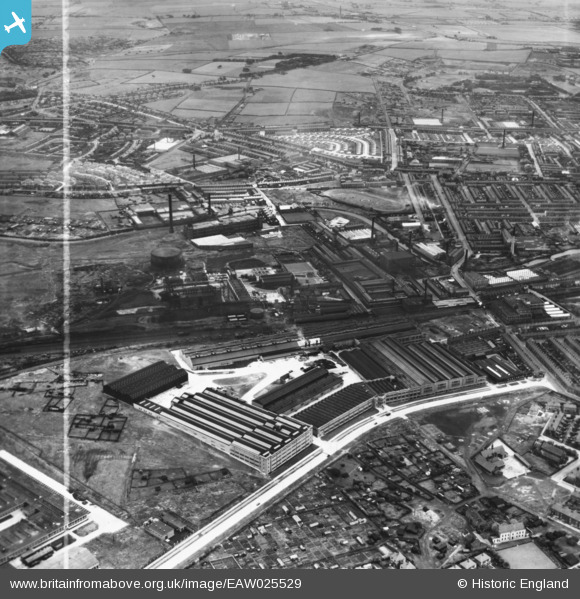
eaw025529 ENGLAND (1949). The Northrop Loom Works and environs, Blackburn, 1949. This image has been produced from a print marked by Aerofilms Ltd for photo editing.
© Copyright OpenStreetMap contributors and licensed by the OpenStreetMap Foundation. 2024. Cartography is licensed as CC BY-SA.
Nearby Images (19)
EAW025529

EPW038983

EAW025530

EAW025531

EPW038980

EPW038981

EAW033861

EAW033866

EPW038982

EAW025532

EPW038979

EAW033860

EAW033859

EAW033862

EAW033863

EAW033865

EAW033864

EAW025537

EAW025538

Details
| Title | [EAW025529] The Northrop Loom Works and environs, Blackburn, 1949. This image has been produced from a print marked by Aerofilms Ltd for photo editing. |
| Reference | EAW025529 |
| Date | 3-August-1949 |
| Link | |
| Place name | BLACKBURN |
| Parish | |
| District | |
| Country | ENGLAND |
| Easting / Northing | 369841, 428824 |
| Longitude / Latitude | -2.4574552937821, 53.754685908491 |
| National Grid Reference | SD698288 |


