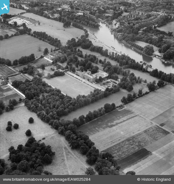
eaw025284 ENGLAND (1949). Ham House, Ham, 1949
© Copyright OpenStreetMap contributors and licensed by the OpenStreetMap Foundation. 2024. Cartography is licensed as CC BY-SA.
Nearby Images (6)
Details
| Title | [EAW025284] Ham House, Ham, 1949 |
| Reference | EAW025284 |
| Date | 22-July-1949 |
| Link | |
| Place name | HAM |
| Parish | |
| District | |
| Country | ENGLAND |
| Easting / Northing | 517308, 173023 |
| Longitude / Latitude | -0.31186160261366, 51.443543907255 |
| National Grid Reference | TQ173730 |
Pins
Be the first to add a comment to this image!


![[EAW025284] Ham House, Ham, 1949](http://britainfromabove.org.uk/sites/all/libraries/aerofilms-images/public/100x100/EAW/025/EAW025284.jpg)
![[EAW025283] Ham House, Ham, 1949](http://britainfromabove.org.uk/sites/all/libraries/aerofilms-images/public/100x100/EAW/025/EAW025283.jpg)
![[EAW025285] Ham House, Ham, 1949](http://britainfromabove.org.uk/sites/all/libraries/aerofilms-images/public/100x100/EAW/025/EAW025285.jpg)
![[EAW025287] Ham House, Ham, 1949](http://britainfromabove.org.uk/sites/all/libraries/aerofilms-images/public/100x100/EAW/025/EAW025287.jpg)
![[EAW025286] Ham House, Ham, 1949](http://britainfromabove.org.uk/sites/all/libraries/aerofilms-images/public/100x100/EAW/025/EAW025286.jpg)
![[EPW018506] Ham House and gardens, Ham, 1927. This image has been produced from a copy-negative.](http://britainfromabove.org.uk/sites/all/libraries/aerofilms-images/public/100x100/EPW/018/EPW018506.jpg)


