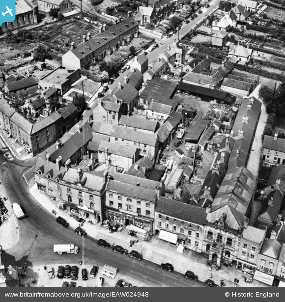
eaw024948 ENGLAND (1949). Town Hall Yard and environs, Ashbourne, 1949. This image has been produced from a print marked by Aerofilms Ltd for photo editing.
© Copyright OpenStreetMap contributors and licensed by the OpenStreetMap Foundation. 2024. Cartography is licensed as CC BY-SA.
Nearby Images (10)
Details
| Title | [EAW024948] Town Hall Yard and environs, Ashbourne, 1949. This image has been produced from a print marked by Aerofilms Ltd for photo editing. |
| Reference | EAW024948 |
| Date | 21-July-1949 |
| Link | |
| Place name | ASHBOURNE |
| Parish | ASHBOURNE |
| District | |
| Country | ENGLAND |
| Easting / Northing | 418054, 346852 |
| Longitude / Latitude | -1.7308401295097, 53.018356058755 |
| National Grid Reference | SK181469 |
Pins
Be the first to add a comment to this image!


![[EAW024948] Town Hall Yard and environs, Ashbourne, 1949. This image has been produced from a print marked by Aerofilms Ltd for photo editing.](http://britainfromabove.org.uk/sites/all/libraries/aerofilms-images/public/100x100/EAW/024/EAW024948.jpg)
![[EAW024944] The Market Place and environs, Ashbourne, 1949. This image has been produced from a print.](http://britainfromabove.org.uk/sites/all/libraries/aerofilms-images/public/100x100/EAW/024/EAW024944.jpg)
![[EAW024952] The town centre, Ashbourne, 1949. This image was marked by Aerofilms Ltd for photo editing.](http://britainfromabove.org.uk/sites/all/libraries/aerofilms-images/public/100x100/EAW/024/EAW024952.jpg)
![[EAW024947] Town Hall Yard, the Church of St John the Baptist and environs, Ashbourne, 1949. This image has been produced from a print.](http://britainfromabove.org.uk/sites/all/libraries/aerofilms-images/public/100x100/EAW/024/EAW024947.jpg)
![[EAW024945] The Market Place and environs, Ashbourne, 1949. This image has been produced from a print marked by Aerofilms Ltd for photo editing.](http://britainfromabove.org.uk/sites/all/libraries/aerofilms-images/public/100x100/EAW/024/EAW024945.jpg)
![[EAW024951] The Town Hall, the Church of St John the Baptist and the Cattle Market, Ashbourne, 1949. This image was marked by Aerofilms Ltd for photo editing.](http://britainfromabove.org.uk/sites/all/libraries/aerofilms-images/public/100x100/EAW/024/EAW024951.jpg)
![[EAW024950] Town Hall Yard and the Market Place, Ashbourne, 1949. This image has been produced from a damaged negative.](http://britainfromabove.org.uk/sites/all/libraries/aerofilms-images/public/100x100/EAW/024/EAW024950.jpg)
![[EAW024949] Town Hall Yard and the Market Place (site of), Ashbourne, 1949. This image has been produced from a damaged negative.](http://britainfromabove.org.uk/sites/all/libraries/aerofilms-images/public/100x100/EAW/024/EAW024949.jpg)
![[EAW024953] The Market Place, the Church of John the Baptist and the Cattle Market, Ashbourne, 1949. This image was marked by Aerofilms Ltd for photo editing.](http://britainfromabove.org.uk/sites/all/libraries/aerofilms-images/public/100x100/EAW/024/EAW024953.jpg)
![[EAW024946] Town Hall Yard and environs, Ashbourne, 1949. This image has been produced from a print.](http://britainfromabove.org.uk/sites/all/libraries/aerofilms-images/public/100x100/EAW/024/EAW024946.jpg)


