
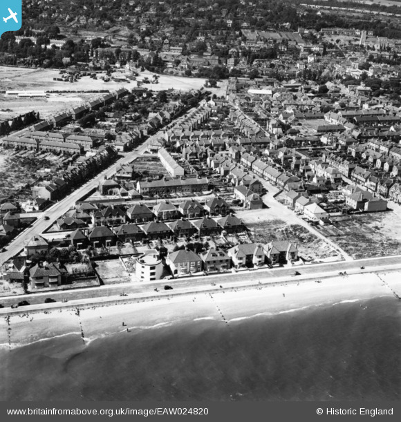
eaw024820 ENGLAND (1949). The Martello Tower off West Parade, St Leonard's Road and environs, Hythe, 1949. This image has been produced from a print.
© Copyright OpenStreetMap contributors and licensed by the OpenStreetMap Foundation. 2024. Cartography is licensed as CC BY-SA.
Nearby Images (4)
EAW024820

EAW004688

EPW000153

EPW026124

Details
| Title | [EAW024820] The Martello Tower off West Parade, St Leonard's Road and environs, Hythe, 1949. This image has been produced from a print. |
| Reference | EAW024820 |
| Date | 12-July-1949 |
| Link | |
| Place name | HYTHE |
| Parish | HYTHE |
| District | |
| Country | ENGLAND |
| Easting / Northing | 615900, 134102 |
| Longitude / Latitude | 1.0817484603534, 51.065052807044 |
| National Grid Reference | TR159341 |
Pins
 John W |
Sunday 29th of January 2017 05:02:17 PM | |
Pedro |
Friday 22nd of July 2016 12:25:38 AM | |
When I was at school in 1950 |
Pedro |
Friday 22nd of July 2016 12:26:25 AM |
The Laird |
Monday 13th of April 2015 04:16:14 PM | |
The Laird |
Sunday 12th of April 2015 02:27:21 PM | |
The Laird |
Sunday 12th of April 2015 02:12:30 PM |


