
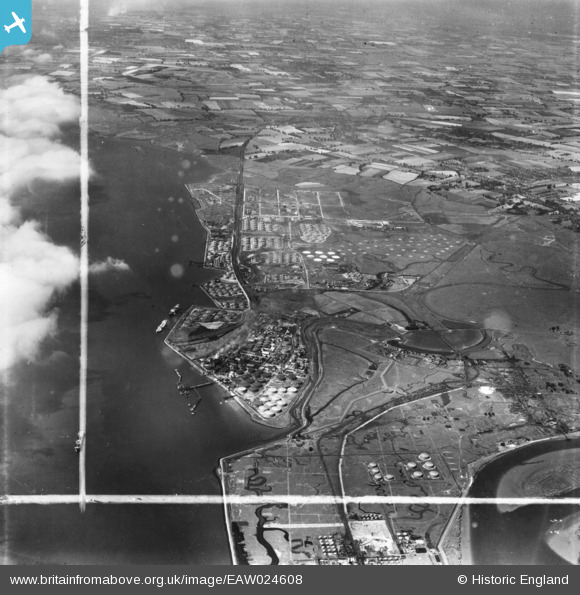
eaw024608 ENGLAND (1949). Shell Haven Oil Refinery, Coryton, from the east, 1949. This image has been produced from a print marked by Aerofilms Ltd for photo editing.
© Copyright OpenStreetMap contributors and licensed by the OpenStreetMap Foundation. 2024. Cartography is licensed as CC BY-SA.
Nearby Images (35)
EAW024608

EAW045730

EAW034435

EAW034403

EAW047421

EAW051371

EAW034437

EAW035783

EAW043887

EPW032109

EAW048086

EAW035772

EAW048095

EAW048302

EAW039884

EAW048587

EAW045734

EAW034436

EAW048089

EAW043886

EAW035778

EAW047430

EAW039881

EAW048367

EAW047427

EAW039894

EAW034404

EAW042274

EAW034440

EAW048102

EAW034438

EAW035779

EAW039886

EPW032110

EAW034407

Details
| Title | [EAW024608] Shell Haven Oil Refinery, Coryton, from the east, 1949. This image has been produced from a print marked by Aerofilms Ltd for photo editing. |
| Reference | EAW024608 |
| Date | 11-July-1949 |
| Link | |
| Place name | CORYTON |
| Parish | |
| District | |
| Country | ENGLAND |
| Easting / Northing | 574875, 182014 |
| Longitude / Latitude | 0.52029693162145, 51.509470846706 |
| National Grid Reference | TQ749820 |
Pins
Be the first to add a comment to this image!


