
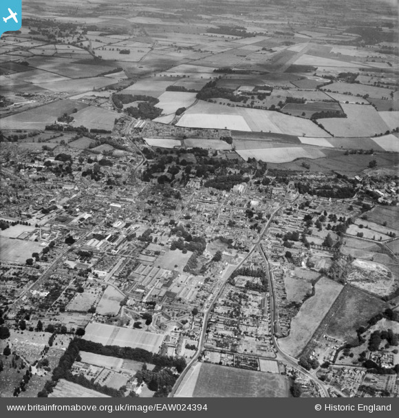
eaw024394 ENGLAND (1949). The town, Bury St Edmunds, from the west, 1949
© Copyright OpenStreetMap contributors and licensed by the OpenStreetMap Foundation. 2024. Cartography is licensed as CC BY-SA.
Details
| Title | [EAW024394] The town, Bury St Edmunds, from the west, 1949 |
| Reference | EAW024394 |
| Date | 6-July-1949 |
| Link | |
| Place name | BURY ST EDMUNDS |
| Parish | BURY ST. EDMUNDS |
| District | |
| Country | ENGLAND |
| Easting / Northing | 584829, 263839 |
| Longitude / Latitude | 0.70740411286987, 52.24125879504 |
| National Grid Reference | TL848638 |
Pins
 Matt Aldred edob.mattaldred.com |
Sunday 8th of November 2020 09:39:46 PM | |
Matt Aldred edob.mattaldred.com |
Sunday 8th of November 2020 09:36:26 PM | |
Matt Aldred edob.mattaldred.com |
Thursday 9th of January 2020 02:23:37 PM | |
Matt Aldred edob.mattaldred.com |
Tuesday 7th of May 2019 04:48:17 PM | |
Matt Aldred edob.mattaldred.com |
Tuesday 7th of May 2019 04:47:59 PM |


