
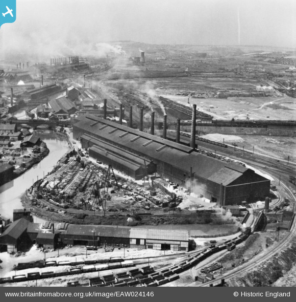
eaw024146 ENGLAND (1949). Part of the Steel, Peech and Tozer Ickles Steel Works, Templeborough, from the east, 1949. This image has been produced from a print.
© Copyright OpenStreetMap contributors and licensed by the OpenStreetMap Foundation. 2024. Cartography is licensed as CC BY-SA.
Nearby Images (16)
EAW024146

EAW048630

EAW048638

EAW048637

EAW048635

EAW049659

EAW025972

EAW029397

EAW048631

EAW048634

EAW049662

EAW048649

EAW049658

EAW048629

EAW030494

EPW041705

Details
| Title | [EAW024146] Part of the Steel, Peech and Tozer Ickles Steel Works, Templeborough, from the east, 1949. This image has been produced from a print. |
| Reference | EAW024146 |
| Date | 22-June-1949 |
| Link | |
| Place name | TEMPLEBOROUGH |
| Parish | |
| District | |
| Country | ENGLAND |
| Easting / Northing | 442134, 392139 |
| Longitude / Latitude | -1.3658731553959, 53.424102078558 |
| National Grid Reference | SK421921 |
Pins
Be the first to add a comment to this image!


