
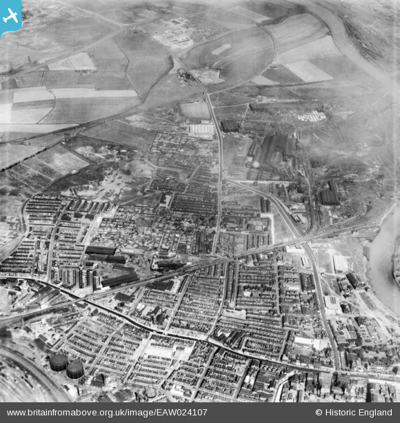
eaw024107 ENGLAND (1949). St Ann's Hill, Stockton-on-Tees, 1949. This image has been produced from a print.
© Copyright OpenStreetMap contributors and licensed by the OpenStreetMap Foundation. 2024. Cartography is licensed as CC BY-SA.
Nearby Images (2)
EAW024107

EPW038901

Details
| Title | [EAW024107] St Ann's Hill, Stockton-on-Tees, 1949. This image has been produced from a print. |
| Reference | EAW024107 |
| Date | 22-June-1949 |
| Link | |
| Place name | STOCKTON-ON-TEES |
| Parish | |
| District | |
| Country | ENGLAND |
| Easting / Northing | 445189, 519732 |
| Longitude / Latitude | -1.3009450817162, 54.570663123971 |
| National Grid Reference | NZ452197 |
Pins
 J May |
Tuesday 25th of July 2023 02:10:10 PM | |
J May |
Tuesday 25th of July 2023 02:05:29 PM | |
J May |
Tuesday 25th of July 2023 02:04:14 PM | |
J May |
Friday 12th of May 2023 04:34:42 PM | |
J May |
Monday 1st of March 2021 06:28:31 PM | |
J May |
Monday 1st of March 2021 06:24:28 PM | |
J May |
Friday 5th of February 2021 02:45:28 PM | |
J May |
Friday 5th of February 2021 02:40:04 PM | |
J May |
Friday 5th of February 2021 02:37:36 PM | |
Danhol |
Saturday 14th of March 2020 03:01:11 PM | |
J May |
Monday 29th of February 2016 07:17:03 PM | |
Fred Starr |
Saturday 27th of December 2014 11:30:00 AM | |
Fred Starr |
Thursday 25th of December 2014 11:17:34 PM | |
Fred Starr |
Thursday 25th of December 2014 11:13:28 PM | |
Fred Starr |
Thursday 25th of December 2014 11:09:41 PM | |
Fred Starr |
Thursday 25th of December 2014 11:07:30 PM | |
J May |
Wednesday 12th of November 2014 11:13:02 PM | |
J May |
Wednesday 12th of November 2014 11:09:59 PM | |
J May |
Wednesday 12th of November 2014 11:09:15 PM | |
The North Shore Branch was originally the main branch line from the Clarence Railway of 1833. The line was supposed to link to a more convenient site for off loading coaling at the River Tees, slightly downstream of Stockton |
Fred Starr |
Thursday 25th of December 2014 11:02:27 PM |
J May |
Wednesday 12th of November 2014 11:08:02 PM | |
J May |
Wednesday 12th of November 2014 11:05:50 PM | |
J May |
Wednesday 12th of November 2014 11:05:18 PM | |
J May |
Wednesday 12th of November 2014 11:04:26 PM | |
J May |
Wednesday 12th of November 2014 11:01:23 PM | |
J May |
Wednesday 12th of November 2014 10:55:44 PM | |
J May |
Wednesday 12th of November 2014 10:24:41 PM | |
J May |
Wednesday 12th of November 2014 10:19:52 PM | |
J May |
Wednesday 12th of November 2014 10:13:25 PM | |
J May |
Wednesday 12th of November 2014 10:12:49 PM | |
J May |
Wednesday 12th of November 2014 10:10:08 PM |


