
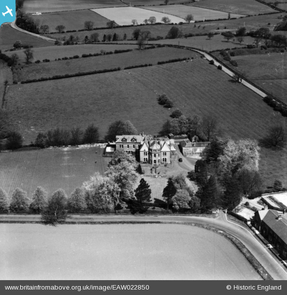
eaw022850 ENGLAND (1949). Corchester Boys' Preparatory School, Corbridge, 1949. This image has been produced from a print.
© Copyright OpenStreetMap contributors and licensed by the OpenStreetMap Foundation. 2024. Cartography is licensed as CC BY-SA.
Nearby Images (4)
EAW022850

EAW022849

EAW022851

EAW022852

Details
| Title | [EAW022850] Corchester Boys' Preparatory School, Corbridge, 1949. This image has been produced from a print. |
| Reference | EAW022850 |
| Date | 29-April-1949 |
| Link | |
| Place name | CORBRIDGE |
| Parish | CORBRIDGE |
| District | |
| Country | ENGLAND |
| Easting / Northing | 398493, 565029 |
| Longitude / Latitude | -2.0235489011261, 54.979788898339 |
| National Grid Reference | NY985650 |
Pins
Be the first to add a comment to this image!


