
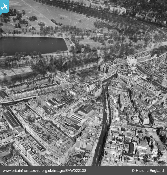
eaw022138 ENGLAND (1949). Brompton Road and Hyde Park, Knightsbridge, 1949
© Copyright OpenStreetMap contributors and licensed by the OpenStreetMap Foundation. 2024. Cartography is licensed as CC BY-SA.
Nearby Images (7)
EAW022138

EAW000555

EAW021419

EAW022139

EPW016659

EPW045420

EPW030076

Details
| Title | [EAW022138] Brompton Road and Hyde Park, Knightsbridge, 1949 |
| Reference | EAW022138 |
| Date | 14-April-1949 |
| Link | |
| Place name | KNIGHTSBRIDGE |
| Parish | |
| District | |
| Country | ENGLAND |
| Easting / Northing | 527672, 179690 |
| Longitude / Latitude | -0.16038676173383, 51.501224591402 |
| National Grid Reference | TQ277797 |
Pins
 Mark B |
Monday 5th of December 2022 01:17:26 PM | |
Starcross |
Saturday 31st of December 2016 06:33:40 PM | |
 Alan McFaden |
Thursday 19th of December 2013 12:49:12 PM | |
Alan McFaden |
Thursday 19th of December 2013 12:44:30 PM |


