
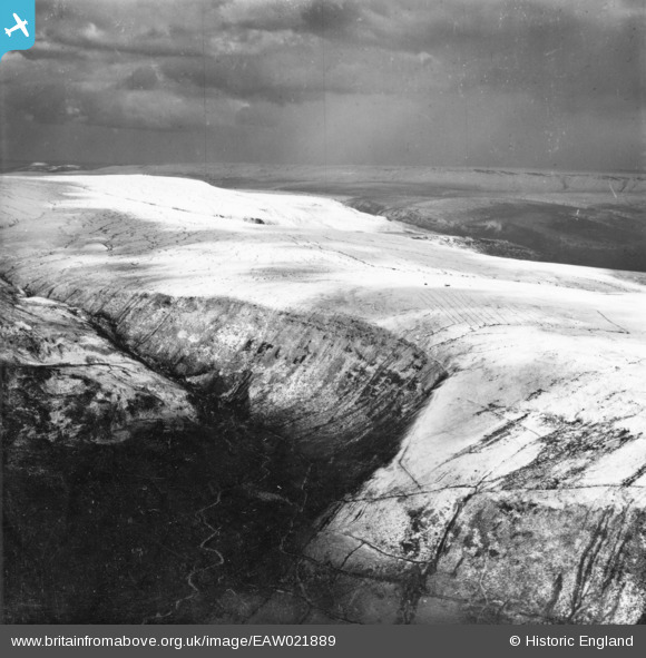
eaw021889 ENGLAND (1949). Snow around Torside Clough, Charlesworth, from the north, 1949. This image has been produced from a print.
© Copyright OpenStreetMap contributors and licensed by the OpenStreetMap Foundation. 2024. Cartography is licensed as CC BY-SA.
Details
| Title | [EAW021889] Snow around Torside Clough, Charlesworth, from the north, 1949. This image has been produced from a print. |
| Reference | EAW021889 |
| Date | 8-April-1949 |
| Link | |
| Place name | TORSIDE CLOUGH |
| Parish | CHARLESWORTH |
| District | |
| Country | ENGLAND |
| Easting / Northing | 406731, 397023 |
| Longitude / Latitude | -1.8985889969411, 53.469647241844 |
| National Grid Reference | SK067970 |
Pins
 Class31 |
Monday 6th of October 2014 09:34:43 AM | |
Class31 |
Monday 6th of October 2014 08:26:02 AM | |
Class31 |
Monday 6th of October 2014 08:25:12 AM | |
Class31 |
Sunday 5th of October 2014 08:11:12 AM | |
Class31 |
Sunday 5th of October 2014 08:10:50 AM |
User Comment Contributions
 The Pennine Way Long Distance Footpath runs along the edge of Torside Clough. Alfred Wainwright produced a wonderful handwritten Pictorial Guide to the Pennine Way (and also to lots of other areas including the English Lake District). I have included the relevant page for this area to show the quality of his work and as an opportunity to say how much his books inspired me to get out and explore the country. |
Class31 |
Monday 6th of October 2014 08:43:56 AM |
This is Torside Clough looking approximately south east. The field boundaries fit for this location. |
Class31 |
Sunday 5th of October 2014 07:52:30 AM |
Eureka |
Class31 |
Sunday 5th of October 2014 07:51:27 AM |


