
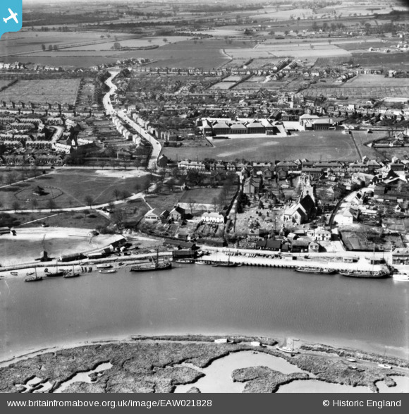
eaw021828 ENGLAND (1949). St Mary's Church and environs, Maldon, 1949. This image has been produced from a print.
© Copyright OpenStreetMap contributors and licensed by the OpenStreetMap Foundation. 2024. Cartography is licensed as CC BY-SA.
Nearby Images (7)
EAW021828

EAW021832

EAW021830

EPW054683

EAW043493

EAW001531

EPW054678

Details
| Title | [EAW021828] St Mary's Church and environs, Maldon, 1949. This image has been produced from a print. |
| Reference | EAW021828 |
| Date | 9-April-1949 |
| Link | |
| Place name | MALDON |
| Parish | MALDON |
| District | |
| Country | ENGLAND |
| Easting / Northing | 585701, 206665 |
| Longitude / Latitude | 0.68920763588222, 51.727443369345 |
| National Grid Reference | TL857067 |
Pins
Be the first to add a comment to this image!


