
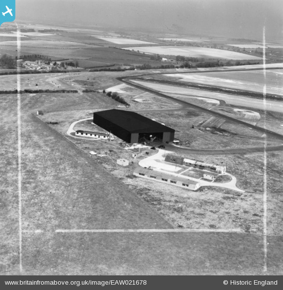
eaw021678 ENGLAND (1949). Hangar at Tarrant Rushton Airfield, Tarrant Rushton, from the south-west, 1949. This image has been produced from a print marked by Aerofilms Ltd for photo editing.
© Copyright OpenStreetMap contributors and licensed by the OpenStreetMap Foundation. 2024. Cartography is licensed as CC BY-SA.
Nearby Images (3)
EAW021678

EAW021673

EAW021679

Details
| Title | [EAW021678] Hangar at Tarrant Rushton Airfield, Tarrant Rushton, from the south-west, 1949. This image has been produced from a print marked by Aerofilms Ltd for photo editing. |
| Reference | EAW021678 |
| Date | 24-March-1949 |
| Link | |
| Place name | TARRANT RUSHTON |
| Parish | TARRANT RUSHTON |
| District | |
| Country | ENGLAND |
| Easting / Northing | 394200, 105615 |
| Longitude / Latitude | -2.0823984689561, 50.849466087684 |
| National Grid Reference | ST942056 |
Pins
 Sparky |
Sunday 10th of September 2017 09:11:25 AM |


