
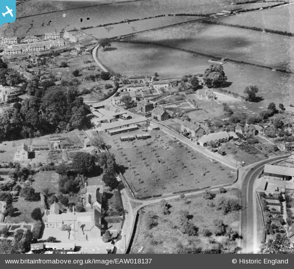
eaw018137 ENGLAND (1948). Studhouse Farm, Pimperne, 1948
© Copyright OpenStreetMap contributors and licensed by the OpenStreetMap Foundation. 2024. Cartography is licensed as CC BY-SA.
Nearby Images (2)
EAW018137

EAW018136

Details
| Title | [EAW018137] Studhouse Farm, Pimperne, 1948 |
| Reference | EAW018137 |
| Date | 16-August-1948 |
| Link | |
| Place name | PIMPERNE |
| Parish | PIMPERNE |
| District | |
| Country | ENGLAND |
| Easting / Northing | 390569, 109307 |
| Longitude / Latitude | -2.1340778362383, 50.882622119311 |
| National Grid Reference | ST906093 |
Pins
Be the first to add a comment to this image!


