
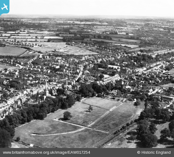
eaw017254 ENGLAND (1948). The town, Hemel Hempstead, from the north-west, 1948. This image has been produced from a print.
© Copyright OpenStreetMap contributors and licensed by the OpenStreetMap Foundation. 2024. Cartography is licensed as CC BY-SA.
Nearby Images (18)
EAW017254

EAW017261

EAW017253

EAW017257

EAW017255

EAW017260

EAW017256

EPR000482

EAW017252

EAW017251

EAW014881

EPW017817

EPW017818

EAW014882

EPW017820

EPW052866
 and environs, Hemel Hempstead, 1937")
EAW014884

EPW052865
, Hemel Hempstead, 1937")
Details
| Title | [EAW017254] The town, Hemel Hempstead, from the north-west, 1948. This image has been produced from a print. |
| Reference | EAW017254 |
| Date | 20-July-1948 |
| Link | |
| Place name | HEMEL HEMPSTEAD |
| Parish | |
| District | |
| Country | ENGLAND |
| Easting / Northing | 505358, 207843 |
| Longitude / Latitude | -0.47329843340366, 51.758896655571 |
| National Grid Reference | TL054078 |
Pins
Be the first to add a comment to this image!


