
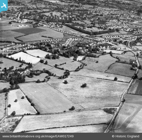
eaw017249 ENGLAND (1948). Hereford Road, Meole Crescent and environs, Meole Brace, 1948. This image has been produced from a print.
© Copyright OpenStreetMap contributors and licensed by the OpenStreetMap Foundation. 2024. Cartography is licensed as CC BY-SA.
Nearby Images (2)
EAW017249

EAW017247

Details
| Title | [EAW017249] Hereford Road, Meole Crescent and environs, Meole Brace, 1948. This image has been produced from a print. |
| Reference | EAW017249 |
| Date | 19-July-1948 |
| Link | |
| Place name | MEOLE BRACE |
| Parish | SHREWSBURY |
| District | |
| Country | ENGLAND |
| Easting / Northing | 348685, 310353 |
| Longitude / Latitude | -2.7592550739712, 52.688087295329 |
| National Grid Reference | SJ487104 |
Pins
Be the first to add a comment to this image!


