
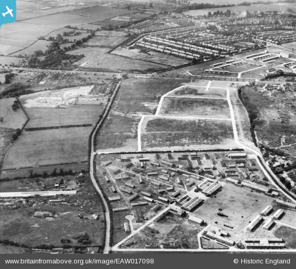
eaw017098 ENGLAND (1948). The site of the housing estate surrounding Arundel Road and Beavers Lane alongside Beavers Lane Camp, Hounslow West, 1948. This image has been produced from a print.
© Copyright OpenStreetMap contributors and licensed by the OpenStreetMap Foundation. 2024. Cartography is licensed as CC BY-SA.
Nearby Images (9)
EAW017098

EAW017096

EAW017102

EAW017101

EAW017100

EAW017099

EAW017103

EAW017097

EPW017159

Details
| Title | [EAW017098] The site of the housing estate surrounding Arundel Road and Beavers Lane alongside Beavers Lane Camp, Hounslow West, 1948. This image has been produced from a print. |
| Reference | EAW017098 |
| Date | 6-July-1948 |
| Link | |
| Place name | HOUNSLOW WEST |
| Parish | |
| District | |
| Country | ENGLAND |
| Easting / Northing | 511102, 175670 |
| Longitude / Latitude | -0.40029983849916, 51.468589646544 |
| National Grid Reference | TQ111757 |
Pins
Be the first to add a comment to this image!


