
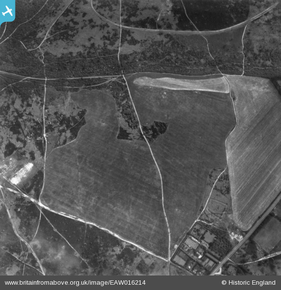
eaw016214 ENGLAND (1948). Earthwork enclosures near the Dorking Road, Banstead Heath, 1948. This image has been produced from a print.
© Copyright OpenStreetMap contributors and licensed by the OpenStreetMap Foundation. 2024. Cartography is licensed as CC BY-SA.
Nearby Images (5)
EAW016214

EAW016212

EAW016211

EAW016213

EAW016210

Details
| Title | [EAW016214] Earthwork enclosures near the Dorking Road, Banstead Heath, 1948. This image has been produced from a print. |
| Reference | EAW016214 |
| Date | 8-June-1948 |
| Link | |
| Place name | BANSTEAD HEATH |
| Parish | |
| District | |
| Country | ENGLAND |
| Easting / Northing | 523795, 155139 |
| Longitude / Latitude | -0.22478379417659, 51.281414670056 |
| National Grid Reference | TQ238551 |
Pins
Be the first to add a comment to this image!


