
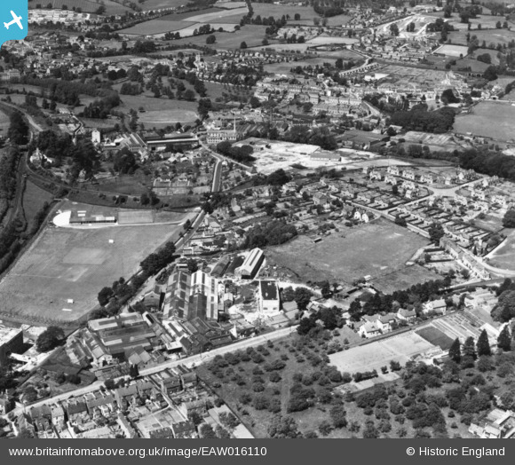
eaw016110 ENGLAND (1948). The Lightpill Iron Works, Dudbridge Road and environs, Lightpill, 1948. This image has been produced from a print.
© Copyright OpenStreetMap contributors and licensed by the OpenStreetMap Foundation. 2024. Cartography is licensed as CC BY-SA.
Nearby Images (10)
EAW016110

EAW016114

EAW016109

EAW016112

EPW041881

EAW016116

EAW016115
, Lightpill, from the north-east, 1948. This image has been produced from a damaged negative.")
EAW016111

EAW016113

EPW041882

Details
| Title | [EAW016110] The Lightpill Iron Works, Dudbridge Road and environs, Lightpill, 1948. This image has been produced from a print. |
| Reference | EAW016110 |
| Date | 21-May-1948 |
| Link | |
| Place name | LIGHTPILL |
| Parish | RODBOROUGH |
| District | |
| Country | ENGLAND |
| Easting / Northing | 383848, 204427 |
| Longitude / Latitude | -2.2339373291743, 51.737861337411 |
| National Grid Reference | SO838044 |


