
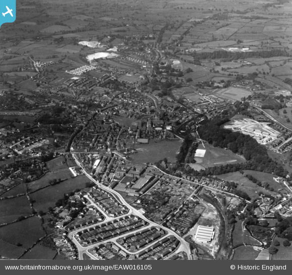
eaw016105 ENGLAND (1948). The town, Congleton, from the east, 1948. This image has been produced from a print.
© Copyright OpenStreetMap contributors and licensed by the OpenStreetMap Foundation. 2024. Cartography is licensed as CC BY-SA.
Nearby Images (13)
EAW016105

EAW035036

EAW035038

EAW035040

EAW035039

EAW035037

EAW035033

EPW028123

EAW035032

EAW035034

EAW035035

EAW035031

EAW016104

Details
| Title | [EAW016105] The town, Congleton, from the east, 1948. This image has been produced from a print. |
| Reference | EAW016105 |
| Date | 21-May-1948 |
| Link | |
| Place name | CONGLETON |
| Parish | CONGLETON |
| District | |
| Country | ENGLAND |
| Easting / Northing | 386643, 363135 |
| Longitude / Latitude | -2.1998116435483, 53.164878471478 |
| National Grid Reference | SJ866631 |
Pins
 bescotbeast |
Monday 14th of March 2022 06:33:26 AM |


