
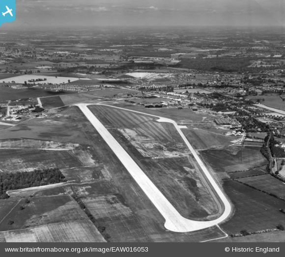
eaw016053 ENGLAND (1948). Hatfield Aerodrome, Hatfield, from the west, 1948. This image has been produced from a print.
© Copyright OpenStreetMap contributors and licensed by the OpenStreetMap Foundation. 2024. Cartography is licensed as CC BY-SA.
Nearby Images (2)
EAW016053

EAW016054

Details
| Title | [EAW016053] Hatfield Aerodrome, Hatfield, from the west, 1948. This image has been produced from a print. |
| Reference | EAW016053 |
| Date | 19-May-1948 |
| Link | |
| Place name | HATFIELD |
| Parish | HATFIELD |
| District | |
| Country | ENGLAND |
| Easting / Northing | 520214, 208574 |
| Longitude / Latitude | -0.25787371083554, 51.762474578865 |
| National Grid Reference | TL202086 |
Pins
 brian |
Friday 20th of January 2017 01:14:07 AM |


