
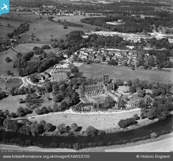
eaw015725 ENGLAND (1948). Kirkstall Abbey and environs, Kirkstall, 1948
© Copyright OpenStreetMap contributors and licensed by the OpenStreetMap Foundation. 2024. Cartography is licensed as CC BY-SA.
Nearby Images (12)
EAW015725

EPW009406

EPW015920

EAW015727

EPW057192

EPW015922

EPW015921

EPW057193

EPW038682

EPW024344

EAW015726

EAW015724

Details
| Title | [EAW015725] Kirkstall Abbey and environs, Kirkstall, 1948 |
| Reference | EAW015725 |
| Date | 18-May-1948 |
| Link | |
| Place name | KIRKSTALL |
| Parish | |
| District | |
| Country | ENGLAND |
| Easting / Northing | 426056, 436232 |
| Longitude / Latitude | -1.604151380259, 53.821496371121 |
| National Grid Reference | SE261362 |
Pins
 Brick Collector |
Sunday 23rd of February 2014 08:20:23 PM | |
Brick Collector |
Sunday 23rd of February 2014 08:18:48 PM |


