
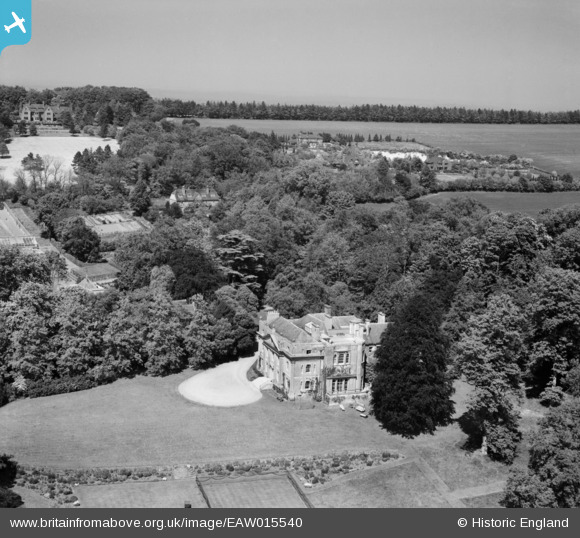
eaw015540 ENGLAND (1948). Puttenham Priory, Puttenham, from the south, 1948
© Copyright OpenStreetMap contributors and licensed by the OpenStreetMap Foundation. 2024. Cartography is licensed as CC BY-SA.
Nearby Images (3)
EAW015540

EAW015538

EAW015539

Details
| Title | [EAW015540] Puttenham Priory, Puttenham, from the south, 1948 |
| Reference | EAW015540 |
| Date | 14-May-1948 |
| Link | |
| Place name | PUTTENHAM |
| Parish | PUTTENHAM |
| District | |
| Country | ENGLAND |
| Easting / Northing | 493332, 147828 |
| Longitude / Latitude | -0.66338091997595, 51.221493100242 |
| National Grid Reference | SU933478 |
Pins
Be the first to add a comment to this image!


