
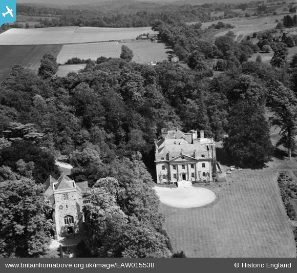
eaw015538 ENGLAND (1948). Puttenham Priory and St John the Baptist's Church, Puttenham, 1948
© Copyright OpenStreetMap contributors and licensed by the OpenStreetMap Foundation. 2024. Cartography is licensed as CC BY-SA.
Nearby Images (3)
EAW015538

EAW015539

EAW015540

Details
| Title | [EAW015538] Puttenham Priory and St John the Baptist's Church, Puttenham, 1948 |
| Reference | EAW015538 |
| Date | 14-May-1948 |
| Link | |
| Place name | PUTTENHAM |
| Parish | PUTTENHAM |
| District | |
| Country | ENGLAND |
| Easting / Northing | 493368, 147835 |
| Longitude / Latitude | -0.66286368644688, 51.221550145327 |
| National Grid Reference | SU934478 |
Pins
Be the first to add a comment to this image!


