
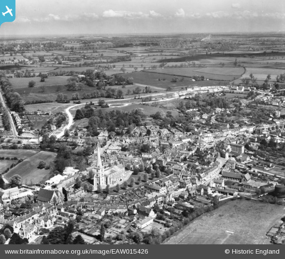
eaw015426 ENGLAND (1948). St Peter & St Paul's Church and the town, Buckingham, from the south-east, 1948. This image has been produced from a print.
© Copyright OpenStreetMap contributors and licensed by the OpenStreetMap Foundation. 2024. Cartography is licensed as CC BY-SA.
Nearby Images (12)
EAW015426

EAW015424

EAW015425

EPW005040

EPW005042

EAW048982

EAW048981

EPW005039

EPW005043

EAW015427

EPW005041

EAW048983

Details
| Title | [EAW015426] St Peter & St Paul's Church and the town, Buckingham, from the south-east, 1948. This image has been produced from a print. |
| Reference | EAW015426 |
| Date | 6-May-1948 |
| Link | |
| Place name | BUCKINGHAM |
| Parish | BUCKINGHAM |
| District | |
| Country | ENGLAND |
| Easting / Northing | 469510, 233788 |
| Longitude / Latitude | -0.98742138696546, 51.997754311475 |
| National Grid Reference | SP695338 |
Pins
Be the first to add a comment to this image!


