
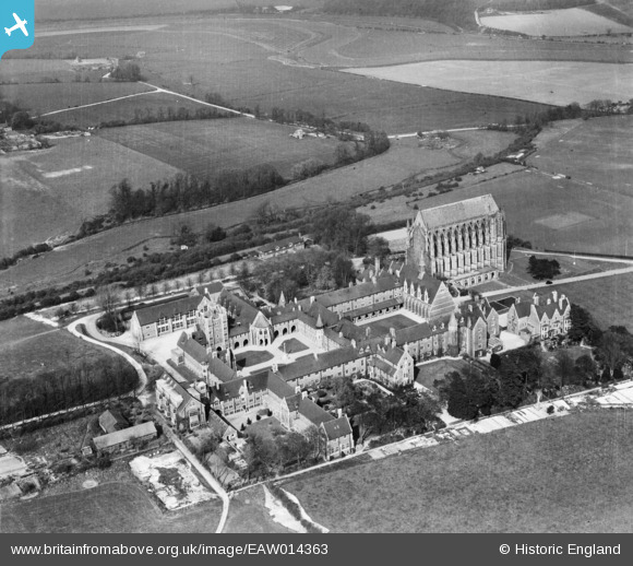
eaw014363 ENGLAND (1948). St Mary and St Nicolas' (Lancing) College, Lancing, 1948
© Copyright OpenStreetMap contributors and licensed by the OpenStreetMap Foundation. 2024. Cartography is licensed as CC BY-SA.
Nearby Images (7)
EAW014363
 College, Lancing, 1948")
EAW026854

EAW026855

EPW000724

EAW039312

EPW018083

EPW000687

Details
| Title | [EAW014363] St Mary and St Nicolas' (Lancing) College, Lancing, 1948 |
| Reference | EAW014363 |
| Date | 13-April-1948 |
| Link | |
| Place name | LANCING |
| Parish | LANCING |
| District | |
| Country | ENGLAND |
| Easting / Northing | 519550, 106659 |
| Longitude / Latitude | -0.30165377828409, 50.846525841442 |
| National Grid Reference | TQ196067 |
Pins
 Alan McFaden |
Tuesday 26th of August 2014 04:14:23 PM | |
Alan McFaden |
Wednesday 8th of January 2014 04:52:57 PM | |
Alan McFaden |
Wednesday 8th of January 2014 04:51:21 PM |


User Comment Contributions
 Lancing College from Shoreham-by-Sea |
Alan McFaden |
Friday 7th of November 2014 05:44:59 PM |


