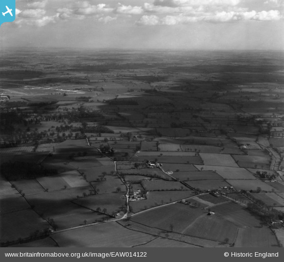
eaw014122 ENGLAND (1948). Countryside around School Farm and College Farm, St Cross South Elmham, from the south-west, 1948. This image has been produced from a print.
© Copyright OpenStreetMap contributors and licensed by the OpenStreetMap Foundation. 2024. Cartography is licensed as CC BY-SA.
Nearby Images (6)
Details
| Title | [EAW014122] Countryside around School Farm and College Farm, St Cross South Elmham, from the south-west, 1948. This image has been produced from a print. |
| Reference | EAW014122 |
| Date | 23-March-1948 |
| Link | |
| Place name | ST CROSS SOUTH ELMHAM |
| Parish | ST. CROSS, SOUTH ELMHAM |
| District | |
| Country | ENGLAND |
| Easting / Northing | 629820, 284694 |
| Longitude / Latitude | 1.3795733340133, 52.411507242832 |
| National Grid Reference | TM298847 |
Pins
Be the first to add a comment to this image!


![[EAW014122] Countryside around School Farm and College Farm, St Cross South Elmham, from the south-west, 1948. This image has been produced from a print.](http://britainfromabove.org.uk/sites/all/libraries/aerofilms-images/public/100x100/EAW/014/EAW014122.jpg)
![[EAW014060] School Farm and College Farm with RAF Bungay Airfield in the distance, St Cross South Elmham, from the south-west, 1948](http://britainfromabove.org.uk/sites/all/libraries/aerofilms-images/public/100x100/EAW/014/EAW014060.jpg)
![[EAW014124] Countryside around School Farm and College Farm, St Cross South Elmham, from the south-west, 1948. This image has been produced from a print.](http://britainfromabove.org.uk/sites/all/libraries/aerofilms-images/public/100x100/EAW/014/EAW014124.jpg)
![[EAW014062] School Farm, Cartwright's Plantation and the surrounding countryside, St Cross South Elmham, from the west, 1948](http://britainfromabove.org.uk/sites/all/libraries/aerofilms-images/public/100x100/EAW/014/EAW014062.jpg)
![[EAW014123] Countryside around School Farm and College Farm, St Cross South Elmham, from the west, 1948. This image has been produced from a print.](http://britainfromabove.org.uk/sites/all/libraries/aerofilms-images/public/100x100/EAW/014/EAW014123.jpg)
![[EAW014059] School Farm and College Farm with RAF Bungay Airfield in the distance, St Cross South Elmham, from the south-west, 1948](http://britainfromabove.org.uk/sites/all/libraries/aerofilms-images/public/100x100/EAW/014/EAW014059.jpg)


