
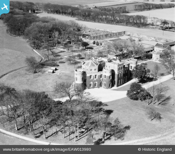
eaw013980 ENGLAND (1948). Grimston Garth, Grimston, 1948
© Copyright OpenStreetMap contributors and licensed by the OpenStreetMap Foundation. 2024. Cartography is licensed as CC BY-SA.
Details
| Title | [EAW013980] Grimston Garth, Grimston, 1948 |
| Reference | EAW013980 |
| Date | 23-March-1948 |
| Link | |
| Place name | GRIMSTON |
| Parish | EAST GARTON |
| District | |
| Country | ENGLAND |
| Easting / Northing | 528289, 435088 |
| Longitude / Latitude | -0.052076282514442, 53.796045497946 |
| National Grid Reference | TA283351 |
Pins
 redmist |
Thursday 10th of January 2019 07:54:19 PM |
User Comment Contributions
Country house dating from the 1780s. Listed Grade I |
MB |
Thursday 6th of February 2014 10:02:23 PM |


