
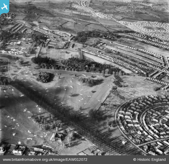
eaw012072 ENGLAND (1947). Wollaton Park and the surrounding residential area, Wollaton, 1947
© Copyright OpenStreetMap contributors and licensed by the OpenStreetMap Foundation. 2024. Cartography is licensed as CC BY-SA.
Nearby Images (3)
EAW012072

EAW012062

EAW012061

Details
| Title | [EAW012072] Wollaton Park and the surrounding residential area, Wollaton, 1947 |
| Reference | EAW012072 |
| Date | 5-November-1947 |
| Link | |
| Place name | WOLLATON |
| Parish | |
| District | |
| Country | ENGLAND |
| Easting / Northing | 453715, 339505 |
| Longitude / Latitude | -1.2004427922822, 52.949920008672 |
| National Grid Reference | SK537395 |
Pins
Be the first to add a comment to this image!


