
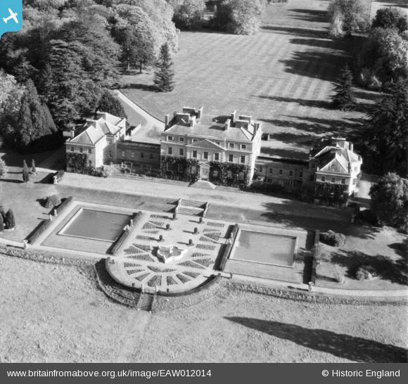
eaw012014 ENGLAND (1947). Trafalgar House, Downton, 1947
© Copyright OpenStreetMap contributors and licensed by the OpenStreetMap Foundation. 2024. Cartography is licensed as CC BY-SA.
Nearby Images (6)
EAW012014

EAW012015

EAW012016

EAW012020

EAW012018

EAW012026

Details
| Title | [EAW012014] Trafalgar House, Downton, 1947 |
| Reference | EAW012014 |
| Date | 3-November-1947 |
| Link | |
| Place name | DOWNTON |
| Parish | DOWNTON |
| District | |
| Country | ENGLAND |
| Easting / Northing | 418538, 123760 |
| Longitude / Latitude | -1.7357156407052, 51.012381244126 |
| National Grid Reference | SU185238 |
Pins
Be the first to add a comment to this image!


