
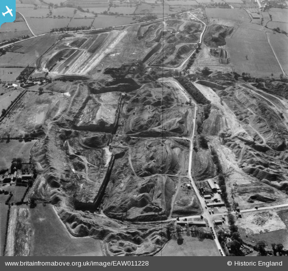
eaw011228 ENGLAND (1947). Opencast coal mining around Dumbles Lane, Smalley, 1947
© Copyright OpenStreetMap contributors and licensed by the OpenStreetMap Foundation. 2025. Cartography is licensed as CC BY-SA.
Nearby Images (14)
EAW011228

EAW011221

EAW017987

EAW017990

EAW017988

EAW017952

EAW017989

EAW011229

EAW017959

EAW017984

EAW017947

EAW017957

EAW017958

EAW011251

Details
| Title | [EAW011228] Opencast coal mining around Dumbles Lane, Smalley, 1947 |
| Reference | EAW011228 |
| Date | 30-September-1947 |
| Link | |
| Place name | SMALLEY |
| Parish | SMALLEY |
| District | |
| Country | ENGLAND |
| Easting / Northing | 441207, 346123 |
| Longitude / Latitude | -1.3857699583137, 53.010520639455 |
| National Grid Reference | SK412461 |
Pins

User Comment Contributions
View looking south. |
 Class31 |
Thursday 9th of January 2014 12:07:10 PM |