
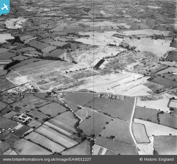
eaw011227 ENGLAND (1947). Opencast coal mining to the north of Heanor Road, Smalley, 1947
© Copyright OpenStreetMap contributors and licensed by the OpenStreetMap Foundation. 2024. Cartography is licensed as CC BY-SA.
Nearby Images (9)
EAW011227

EAW025919

EAW017953

EAW017985

EAW017948

EAW033475

EAW017955

EAW017961

EAW017954

Details
| Title | [EAW011227] Opencast coal mining to the north of Heanor Road, Smalley, 1947 |
| Reference | EAW011227 |
| Date | 30-September-1947 |
| Link | |
| Place name | SMALLEY |
| Parish | SMALLEY |
| District | |
| Country | ENGLAND |
| Easting / Northing | 441494, 345151 |
| Longitude / Latitude | -1.3816171099393, 53.001760496369 |
| National Grid Reference | SK415452 |
Pins
 Matt Aldred edob.mattaldred.com |
Friday 13th of October 2023 02:19:03 PM | |
 Dean77 |
Friday 25th of March 2022 07:25:26 AM | |
 Class31 |
Wednesday 23rd of July 2014 03:03:29 PM | |
Class31 |
Monday 14th of April 2014 11:32:58 AM | |
Class31 |
Monday 14th of April 2014 11:30:46 AM | |
Class31 |
Thursday 9th of January 2014 11:32:52 AM |

User Comment Contributions
Looking north west |
Class31 |
Thursday 9th of January 2014 11:32:35 AM |


