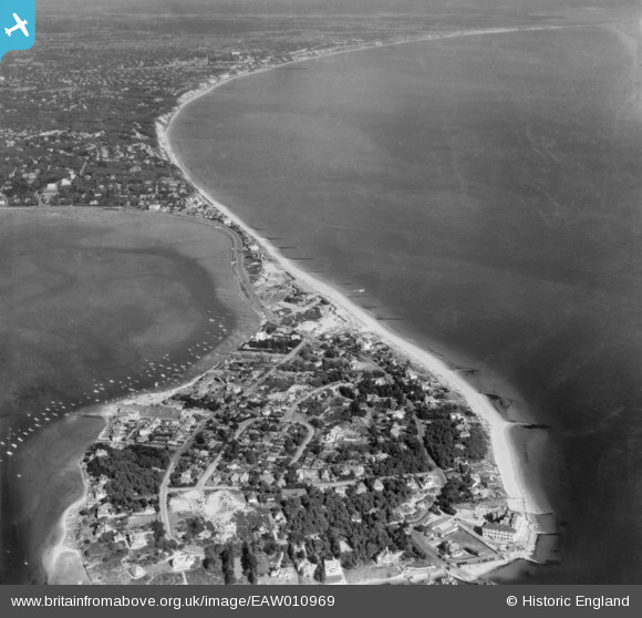
eaw010969 ENGLAND (1947). Sandbanks and Poole Bay, Sandbanks, from the south-west, 1947
© Copyright OpenStreetMap contributors and licensed by the OpenStreetMap Foundation. 2024. Cartography is licensed as CC BY-SA.
Nearby Images (5)
EAW010969

EAW019957

EAW010968

EPW032302

EPW041055

Details
| Title | [EAW010969] Sandbanks and Poole Bay, Sandbanks, from the south-west, 1947 |
| Reference | EAW010969 |
| Date | 24-September-1947 |
| Link | |
| Place name | SANDBANKS |
| Parish | |
| District | |
| Country | ENGLAND |
| Easting / Northing | 403969, 87362 |
| Longitude / Latitude | -1.9438108396546, 50.685320797338 |
| National Grid Reference | SZ040874 |
Pins
 redmist |
Monday 25th of March 2024 08:28:33 PM | |
Oliver |
Sunday 14th of August 2022 01:42:31 AM | |
 Matt Aldred edob.mattaldred.com |
Thursday 23rd of September 2021 01:02:45 PM | |
redmist |
Sunday 9th of August 2020 11:48:37 AM | |
redmist |
Sunday 9th of August 2020 11:48:17 AM | |
redmist |
Sunday 9th of August 2020 11:47:45 AM | |
 Class31 |
Monday 10th of March 2014 11:45:43 AM | |
Class31 |
Monday 10th of March 2014 11:44:28 AM | |
Class31 |
Monday 10th of March 2014 11:34:38 AM | |
Class31 |
Monday 10th of March 2014 11:34:21 AM |