
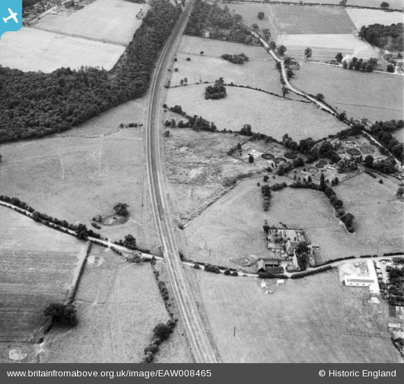
eaw008465 ENGLAND (1947). Skimpans Farm, Hatfield Rural District Council Sewage Farm and the London & North Eastern Railway (LNER) line, Welham Green, 1947
© Copyright OpenStreetMap contributors and licensed by the OpenStreetMap Foundation. 2024. Cartography is licensed as CC BY-SA.
Nearby Images (2)
EAW008465
 line, Welham Green, 1947")
EAW008464

Details
| Title | [EAW008465] Skimpans Farm, Hatfield Rural District Council Sewage Farm and the London & North Eastern Railway (LNER) line, Welham Green, 1947 |
| Reference | EAW008465 |
| Date | 31-July-1947 |
| Link | |
| Place name | WELHAM GREEN |
| Parish | NORTH MYMMS |
| District | |
| Country | ENGLAND |
| Easting / Northing | 523890, 205073 |
| Longitude / Latitude | -0.20587667306773, 51.730207230276 |
| National Grid Reference | TL239051 |
Pins
 Al C |
Friday 10th of February 2017 05:48:33 PM | |
Al C |
Friday 10th of February 2017 05:48:11 PM | |
Al C |
Friday 10th of February 2017 05:47:51 PM | |
Al C |
Friday 10th of February 2017 05:46:47 PM | |
Al C |
Friday 10th of February 2017 05:42:10 PM | |
Al C |
Friday 10th of February 2017 05:41:20 PM | |
Al C |
Friday 10th of February 2017 05:40:40 PM | |
Al C |
Friday 10th of February 2017 05:39:06 PM | |
Al C |
Friday 10th of February 2017 05:37:42 PM | |
Al C |
Friday 10th of February 2017 05:36:44 PM | |
Al C |
Friday 10th of February 2017 05:36:02 PM | |
Al C |
Friday 10th of February 2017 05:35:22 PM |


