
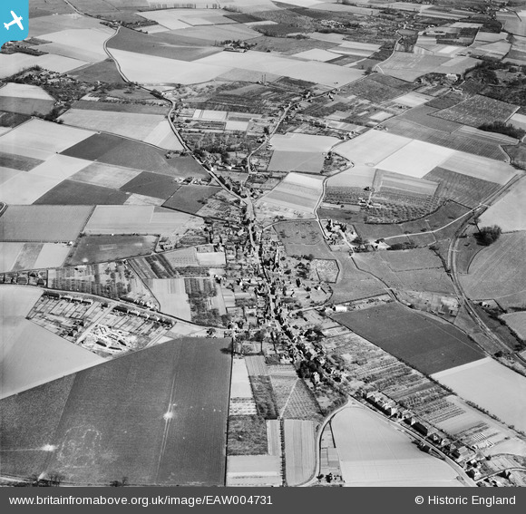
eaw004731 ENGLAND (1947). The village, Ash, 1947
© Copyright OpenStreetMap contributors and licensed by the OpenStreetMap Foundation. 2024. Cartography is licensed as CC BY-SA.
Nearby Images (4)
EAW004731

EAW004733

EAW004732

EAW004734

Details
| Title | [EAW004731] The village, Ash, 1947 |
| Reference | EAW004731 |
| Date | 26-April-1947 |
| Link | |
| Place name | ASH |
| Parish | ASH |
| District | |
| Country | ENGLAND |
| Easting / Northing | 628827, 158386 |
| Longitude / Latitude | 1.2814090844411, 51.278075903682 |
| National Grid Reference | TR288584 |
Pins
 Stu Giles |
Wednesday 27th of June 2018 08:09:27 PM | |
Dave L |
Sunday 8th of February 2015 05:21:36 PM | |
ms08 |
Friday 1st of August 2014 10:00:32 PM | |
totoro |
Wednesday 23rd of October 2013 11:06:27 AM | |
totoro |
Wednesday 23rd of October 2013 11:02:47 AM | |
totoro |
Wednesday 23rd of October 2013 11:02:18 AM | |
totoro |
Wednesday 23rd of October 2013 11:00:34 AM | |
totoro |
Wednesday 23rd of October 2013 10:59:57 AM | |
totoro |
Wednesday 23rd of October 2013 10:58:54 AM | |
totoro |
Wednesday 23rd of October 2013 10:57:51 AM | |
totoro |
Wednesday 23rd of October 2013 10:56:59 AM | |
totoro |
Wednesday 23rd of October 2013 10:55:27 AM | |
totoro |
Wednesday 23rd of October 2013 10:55:01 AM | |
totoro |
Wednesday 23rd of October 2013 10:49:16 AM | |
totoro |
Wednesday 23rd of October 2013 10:45:14 AM | |
totoro |
Wednesday 23rd of October 2013 10:44:52 AM | |
totoro |
Wednesday 23rd of October 2013 10:43:19 AM | |
totoro |
Wednesday 23rd of October 2013 10:42:26 AM | |
totoro |
Wednesday 23rd of October 2013 10:40:41 AM | |
totoro |
Wednesday 23rd of October 2013 10:36:30 AM | |
totoro |
Wednesday 23rd of October 2013 10:34:35 AM | |
totoro |
Wednesday 23rd of October 2013 10:34:19 AM |
User Comment Contributions
This view is looking almost due East |
totoro |
Wednesday 23rd of October 2013 10:44:14 AM |


