
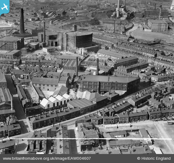
eaw004607 ENGLAND (1947). The Bee Hive Works on Folds Road and environs, Bolton, 1947. This image was marked by Aerofilms Ltd for photo editing.
© Copyright OpenStreetMap contributors and licensed by the OpenStreetMap Foundation. 2024. Cartography is licensed as CC BY-SA.
Nearby Images (10)
EAW004607

EAW004613

EAW004610

EAW004605

EAW004608

EAW004611

EAW004612

EAW004604

EAW004609

EAW004606

Details
| Title | [EAW004607] The Bee Hive Works on Folds Road and environs, Bolton, 1947. This image was marked by Aerofilms Ltd for photo editing. |
| Reference | EAW004607 |
| Date | 17-April-1947 |
| Link | |
| Place name | BOLTON |
| Parish | |
| District | |
| Country | ENGLAND |
| Easting / Northing | 372182, 409864 |
| Longitude / Latitude | -2.4202485068971, 53.584385407807 |
| National Grid Reference | SD722099 |
Pins
 David |
Thursday 26th of June 2014 08:15:07 PM | |
totoro |
Friday 13th of December 2013 06:23:43 PM | |
totoro |
Friday 13th of December 2013 06:21:33 PM | |
totoro |
Friday 13th of December 2013 05:57:30 PM |


