
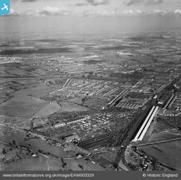
eaw003329 ENGLAND (1946). The Great Western Railway Works and environs, Swindon, from the south-west, 1946
© Copyright OpenStreetMap contributors and licensed by the OpenStreetMap Foundation. 2025. Cartography is licensed as CC BY-SA.
Nearby Images (6)
EAW003329

EAW003320

EAW003328

EAW003330
, Swindon, 1946")
EAW003322

EPW000926

Details
| Title | [EAW003329] The Great Western Railway Works and environs, Swindon, from the south-west, 1946 |
| Reference | EAW003329 |
| Date | 13-November-1946 |
| Link | |
| Place name | SWINDON |
| Parish | |
| District | |
| Country | ENGLAND |
| Easting / Northing | 413417, 184424 |
| Longitude / Latitude | -1.806442265559, 51.55806196428 |
| National Grid Reference | SU134844 |
Pins
 Sparky |
Wednesday 13th of September 2017 09:12:56 AM | |
Gerald Maull |
Sunday 3rd of August 2014 05:01:10 PM | |
Gerald Maull |
Sunday 3rd of August 2014 04:57:24 PM | |
Gerald Maull |
Sunday 3rd of August 2014 04:51:26 PM | |
Mr Goodkat |
Tuesday 27th of May 2014 09:40:50 PM | |
Mr Goodkat |
Tuesday 27th of May 2014 09:32:34 PM | |
Intersection ?? The railways call it a Junction ! |
gerry-r |
Tuesday 3rd of June 2014 01:11:21 AM |
 Class31 |
Tuesday 14th of January 2014 08:39:00 AM | |
Class31 |
Tuesday 14th of January 2014 08:33:34 AM | |
Class31 |
Tuesday 14th of January 2014 08:33:09 AM |